Best Walks in Slovenia: 10 Walks From Lake Bled to the Coast
Ten walks from Lake Bled to the Adriatic coast, with the 270 km Juliana Trail, a map of every route, official distances and climbs and the bus to each start.
Quick links
Don't want to read all this?
We've planned 2,000+ hiking trips. Send your dates, fitness and group size — we'll map the route and book every night.



Walking in Slovenia keeps you close to water for most of the day. Paths circle glacial lakes below the Julian Alps, cross gorges where the river runs a few metres below the boardwalk, and follow the green Soča past wooden suspension bridges.
These ten walks run from the shore of Lake Bled to the old Parenzana railway on the Adriatic coast. They include a waterfall below Triglav's north face, a mountain hut built in 1900 and the 270 km Juliana Trail around the Julian Alps. None of them needs climbing gear, and every start can be reached without a car.
May, June, September and October are the best months, when the valley paths are dry and the summer crowds at Bled have gone.
The 10 Best Walks in Slovenia
The ten walks are numbered as they fall on the map, from Lake Bled through the Julian Alps to the Kamnik-Savinja Alps, then south to the Karst and the coast.
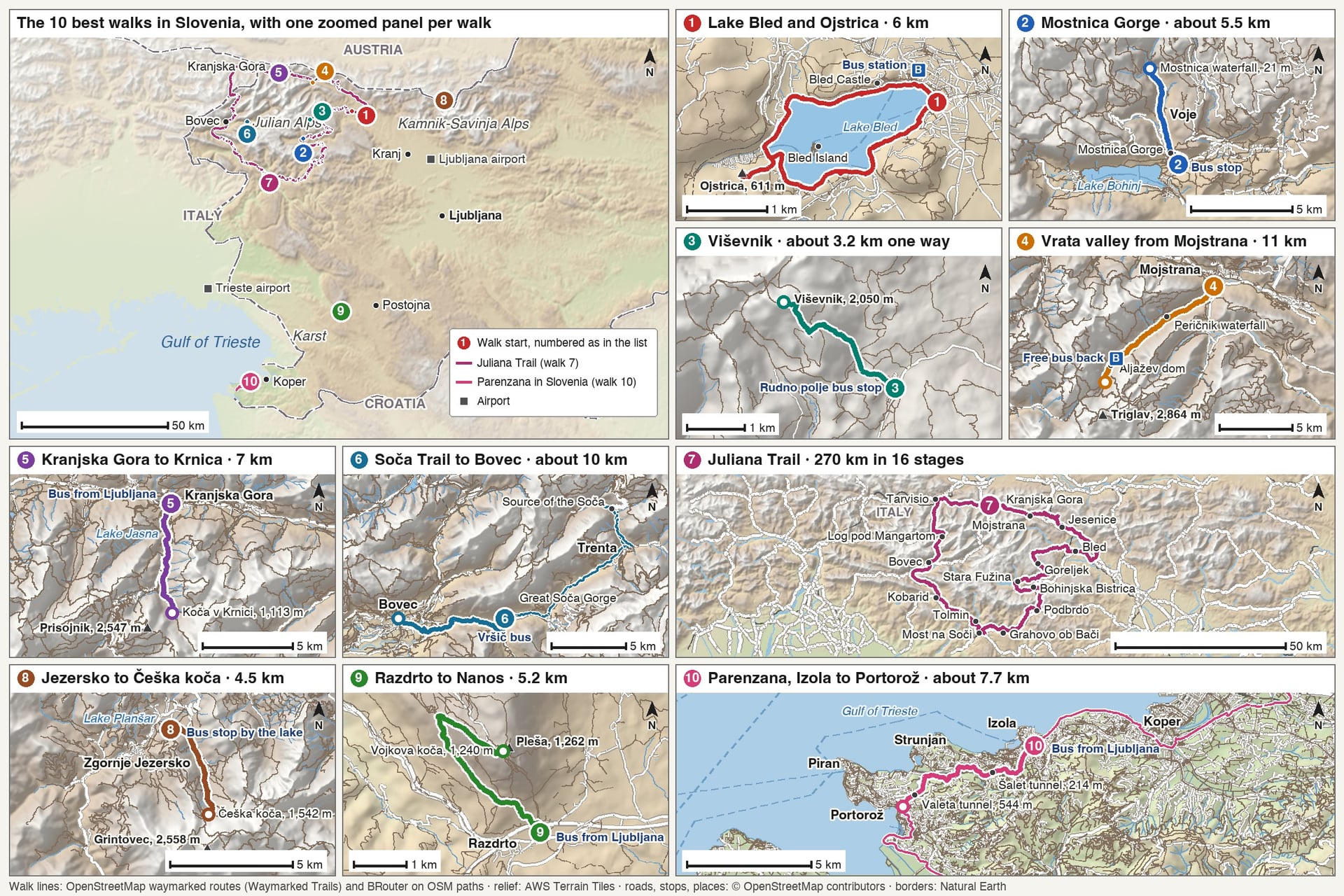
Distances and climbs come from the park, tourist board or Alpine Association in charge of each path. Where none publishes a figure, it was measured on the OpenStreetMap route and is given as "about".
Walk | Distance | Elevation gain | Start | Bus or train to the start |
Lake Bled shore path and Ojstrica | 6 km loop, plus the viewpoint | Almost none; about 140 m to Ojstrica | Bled bus station | Bus from Ljubljana, about 1 hour |
Mostnica Gorge and the Voje valley | About 5.5 km one way | About 250 m | Stara Fužina | Bus to Bohinj, then the local shuttle |
Viševnik from Rudno polje | About 3.2 km one way | About 700 m | Rudno polje, 1,347 m | Summer bus from Bled or Bohinj |
Vrata valley from Mojstrana | 11 km one way | About 420 m | Mojstrana | Free summer bus from Kranjska Gora |
Kranjska Gora to Koča v Krnici | 7 km one way | About 300 m | Kranjska Gora | Bus from Ljubljana, about 2 hours |
Soča Trail to Bovec | About 10 km one way | About 150 m | Great Soča Gorge | Free summer bus over the Vršič Pass |
Juliana Trail | 270 km in 16 stages | About 10,000 m in all | Kranjska Gora | Trains reach six stage towns |
Zgornje Jezersko to Češka koča | 4.5 km one way | 680 m | Zgornje Jezersko | Bus from Kranj, 55 minutes |
Nanos from Razdrto | 5.2 km one way | 673 m | Razdrto | Bus from Ljubljana, about 1 hour |
Parenzana, Izola to Portorož | About 7.7 km one way | Almost none | Izola | Bus from Ljubljana, 1 hour 41 |
Choose by the day you have in mind:
An easy first day: the Lake Bled shore path, 6 km on the flat, then 20 minutes up to Ojstrica
A gorge and a waterfall: Mostnica Gorge to the Voje valley, or the Triglavska Bistrica Trail past Peričnik
A summit without a mountain day: Viševnik, 2,050 m, from a road at 1,347 m
A week on foot: the Juliana Trail, inn to inn, never higher than 1,326 m
Spring walking: Nanos and the Parenzana, on the warmer side of the country
Walks 1 to 7 are in the Julian Alps, in and around Triglav National Park.
1. Lake Bled: Shore Path and Ojstrica Viewpoint
Start: Bled bus station, at the east end of the lake
Distance: 6 km round the lake; the viewpoint adds about 1.5 km there and back
Elevation gain: almost none on the shore path; about 140 m from the lake to Ojstrica
Time: about 1.5 hours round the lake, plus 20 minutes up to Ojstrica
Terrain: asphalt and sandy path by the water, then a short, steep forest path
Getting there: bus from Ljubljana, 58 minutes to 1 hour 19, more than 20 a day
Entry: free
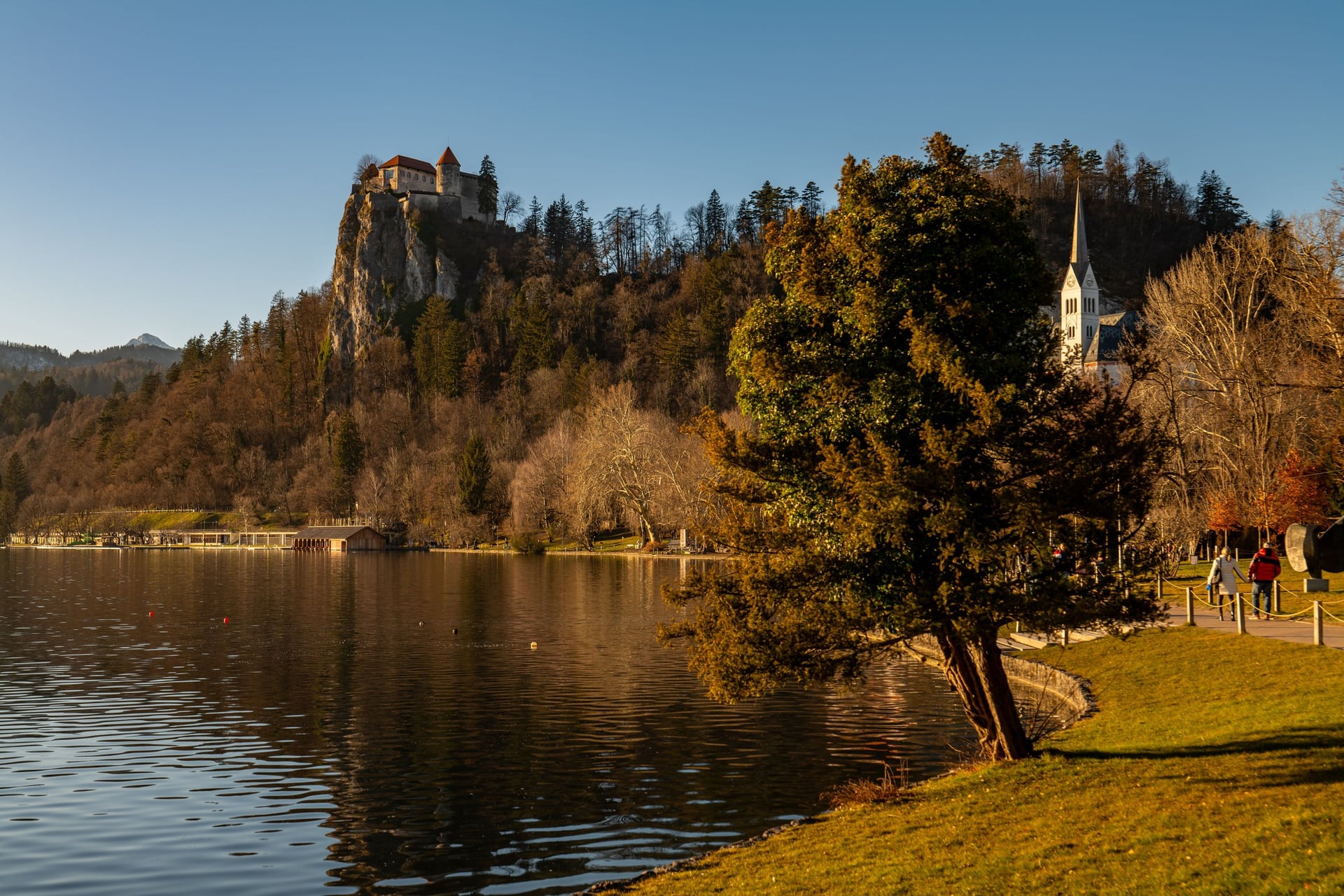
A path runs all the way round Lake Bled, partly asphalt and partly sandy track, and it suits any pair of shoes. The lake lies at 475 m. From the shore you look across to the church on Bled's island and up to the castle on its cliff.
At the west end, beside the Zaka campsite, a forest path climbs to Ojstrica, 611 m. The climb is short but steep, and the view from the top is the one on Bled's postcards. Mala Osojnica, 685 m, is about 45 minutes from the lake on the same path.
Vintgar Gorge, a 1.6 km boardwalk above the Radovna, is 4 km from Bled on foot. Entry is by a timed ticket bought in advance, and the route is one way, with helmets compulsory. Our guide to walks around Lake Bled and Bohinj covers both lakes walk by walk.
2. Lake Bohinj: Mostnica Gorge and the Voje Valley
Start: Stara Fužina, the village at the east end of Lake Bohinj
Distance: about 5.5 km one way to the Mostnica waterfall
Elevation gain: about 250 m
Time: about 2.5 hours one way
Terrain: a path with bridges along the gorge, then a track across the Voje meadows
Getting there: hourly bus from Ljubljana to Bohinjska Bistrica, 1 hour 45, then the Bohinj shuttle to Stara Fužina
Entry: gorge ticket, cash only, 1 April to 30 November
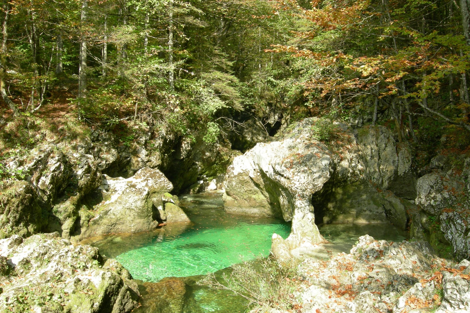
Mostnica Gorge is about 2 km long, and in places its walls stand only a shoulder's width apart. The deepest trough, 20 m, is at Devil's Bridge. Paths run along the rim past green pools and a rock arch known as the Elephant.
Above the gorge the valley opens into the Voje meadows, and the path climbs only twice, for about five minutes each. It ends at the 21 m Mostnica waterfall, also called the Voje waterfall.
The Vogel cable car on the south shore is closed for maintenance until 1 December 2026, so leave the Vogel plateau walks for another year.
3. Pokljuka: The Climb to Viševnik
Start: Rudno polje, 1,347 m, on the Pokljuka plateau
Distance: about 3.2 km one way
Elevation gain: about 700 m
Time: about 2 hours up
Terrain: a former ski slope, then a path between dwarf pines to a grassy summit
Getting there: summer buses only: the Bled Bus Pokljuka line, 1 June to 30 September 2026, or Bohinj line 6, 25 June to 13 September 2026
Entry: free
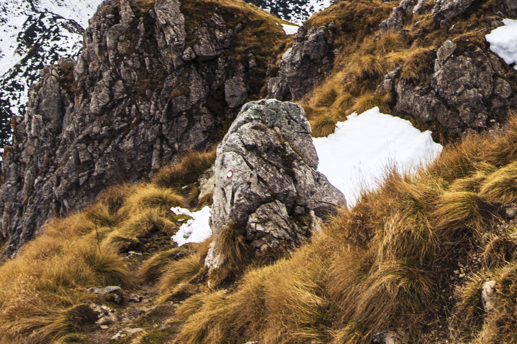
Viševnik, 2,050 m, is a technically easy summit, and the bus does much of the climbing: Rudno polje already lies at 1,347 m. From the top, the view takes in Triglav and the mountains above the Bohinj valley.
Pokljuka itself is a forested plateau between Bled and Bohinj. The Goreljek nature trail crosses one of its peat bogs on boardwalks in about 45 minutes, and the park calls Slovenia's peat bogs the southernmost raised bogs in Europe.
4. Vrata Valley: Peričnik Waterfall and Triglav's North Face
Start: the Slovenian Alpine Museum in Mojstrana
Distance: 11 km one way to the end of the valley; 4 km to Peričnik
Elevation gain: about 420 m
Time: about 3.5 hours one way
Terrain: forest paths and tracks beside the Triglavska Bistrica, easy but long
Getting there: free tourist bus from Kranjska Gora, 21 minutes, 15 June to 15 September 2026
Entry: free
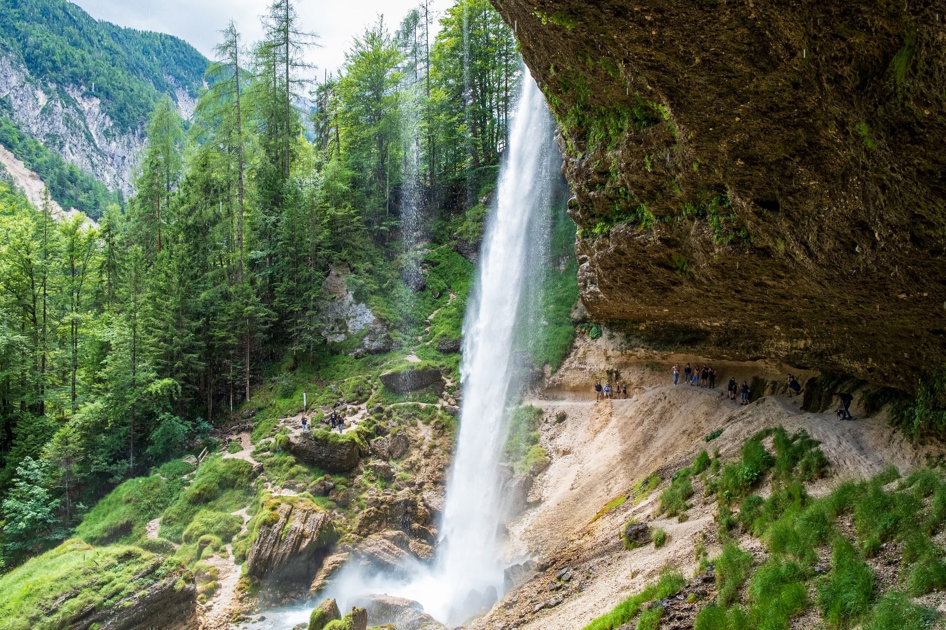
Peričnik is two waterfalls: the lower one falls 52 m over a rock overhang, and a path leads behind the curtain of water. The upper fall, 16 m, is a short climb further. The national park's trail reaches the falls 4 km from Mojstrana.
From Peričnik the Triglavska Bistrica Trail follows the river past Aljažev dom to the end of the Vrata valley. There Triglav's north face fills the view: more than 3 km wide and about 1,000 m high.
A free bus runs from Mojstrana to Aljažev dom from 15 June to 30 September 2026, so you can walk up and ride back down.
5. Kranjska Gora: Lake Jasna and the Krnica Valley
Start: the tourist information centre in Kranjska Gora
Distance: 7 km one way to Koča v Krnici
Elevation gain: about 300 m
Time: about 2 hours one way
Terrain: a gravel path beside the Pišnica, then a forest track up the valley
Getting there: bus from Ljubljana, about 2 hours
Entry: free
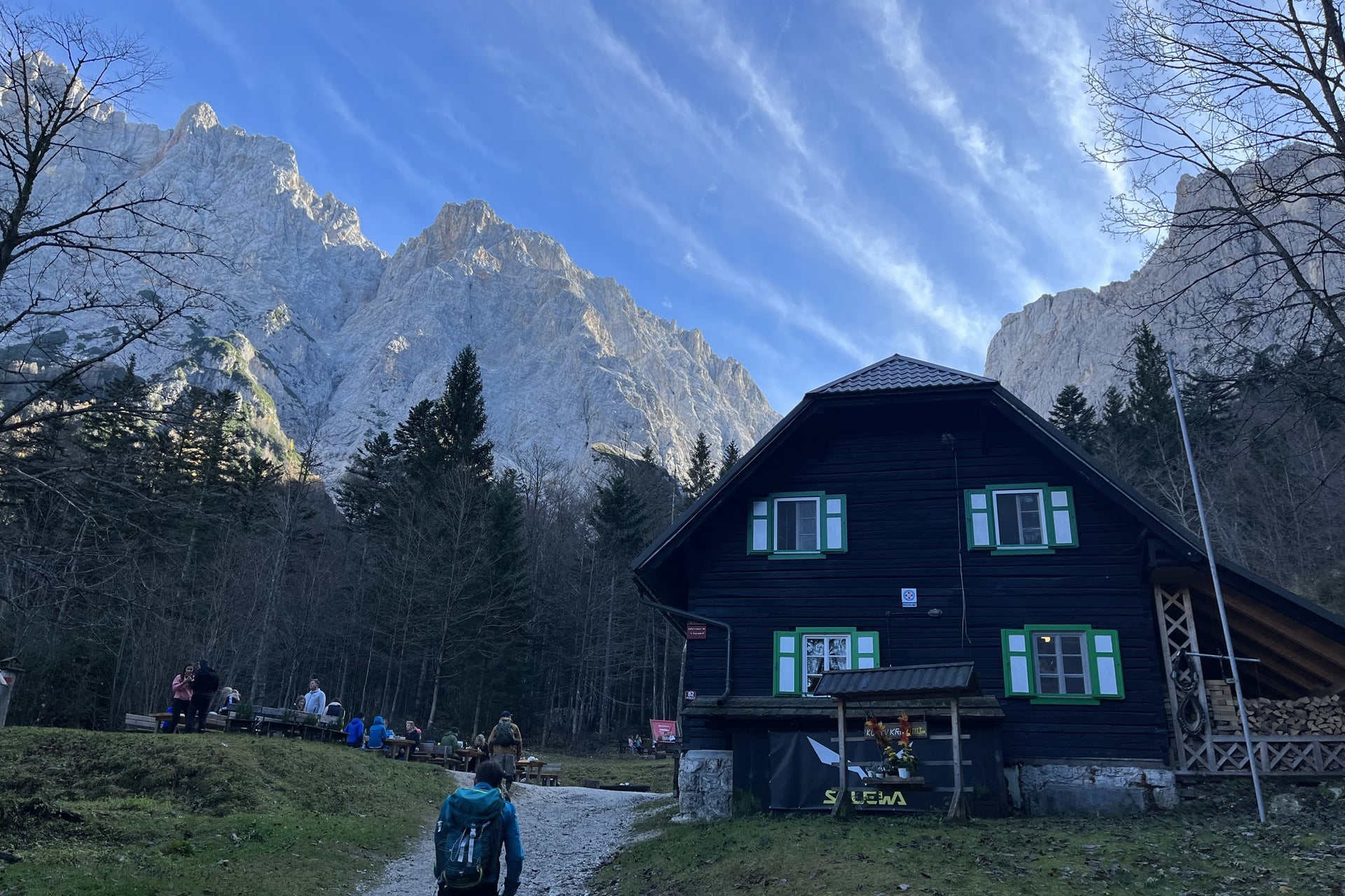
Two small lakes, Jasna, lie a few minutes' walk from the village where the Velika and Mala Pišnica streams meet. The path follows the Pišnica past them into Krnica, a valley about 6 km long, and ends at a hut at 1,113 m, where the north walls of the Julian Alps rise straight above you.
Kranjska Gora has two more good valley walks. From Planica a track climbs to Dom v Tamarju below Jalovec, and from the top of the Vršič Pass Slemenova špica, 1,911 m, is a 75-minute walk away.
6. Soča Trail and Kozjak Waterfall
Start: the Great Soča Gorge bus stop on the Vršič road
Distance: about 10 km to Bovec
Elevation gain: about 150 m
Time: about 3 hours
Terrain: riverside and forest paths, with wooden and suspension bridges
Getting there: free Vršič bus between Kranjska Gora and Bovec, 1 June to 30 September 2026
Entry: free
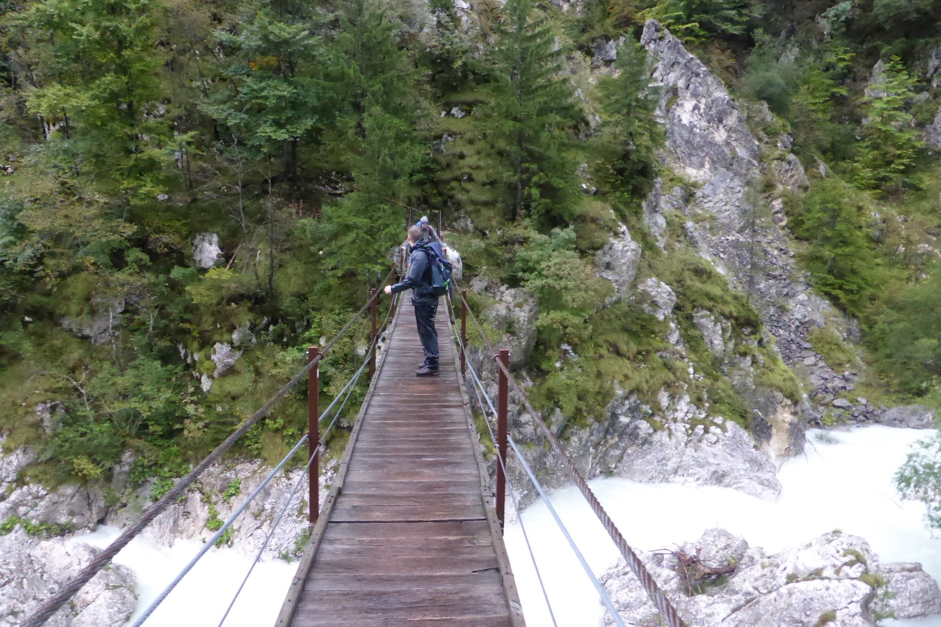
From its source to Bovec, the Soča Trail follows the river for 25 km on easy ground. The lower 10 km make the best single day, and the bus does the uphill part: ride the Vršič bus to the Great Soča Gorge and walk back down to Bovec.
The gorge is 750 m long and up to 15 m deep, with banks in places only 2 m apart. Further south, Kozjak waterfall drops 15 m into a rock chamber, and you can walk there from Kobarid along the river, 8.1 km through the Kobarid gorge. Our guide to walking in the Soča Valley has eight walks between Bovec and Tolmin.
7. The Juliana Trail Around the Julian Alps
Start: Kranjska Gora, though you can join anywhere; from Ljubljana airport, Bled is the usual start
Distance: 270 km in 16 stages
Elevation gain: about 10,000 m in all
Time: 16 walking days; stages average 17.5 km and 4 to 5 hours
Terrain: forest paths, farm tracks and village lanes, never higher than 1,326 m
Getting there: trains stop at six stage towns, from Jesenice and Bled to Most na Soči
Entry: free
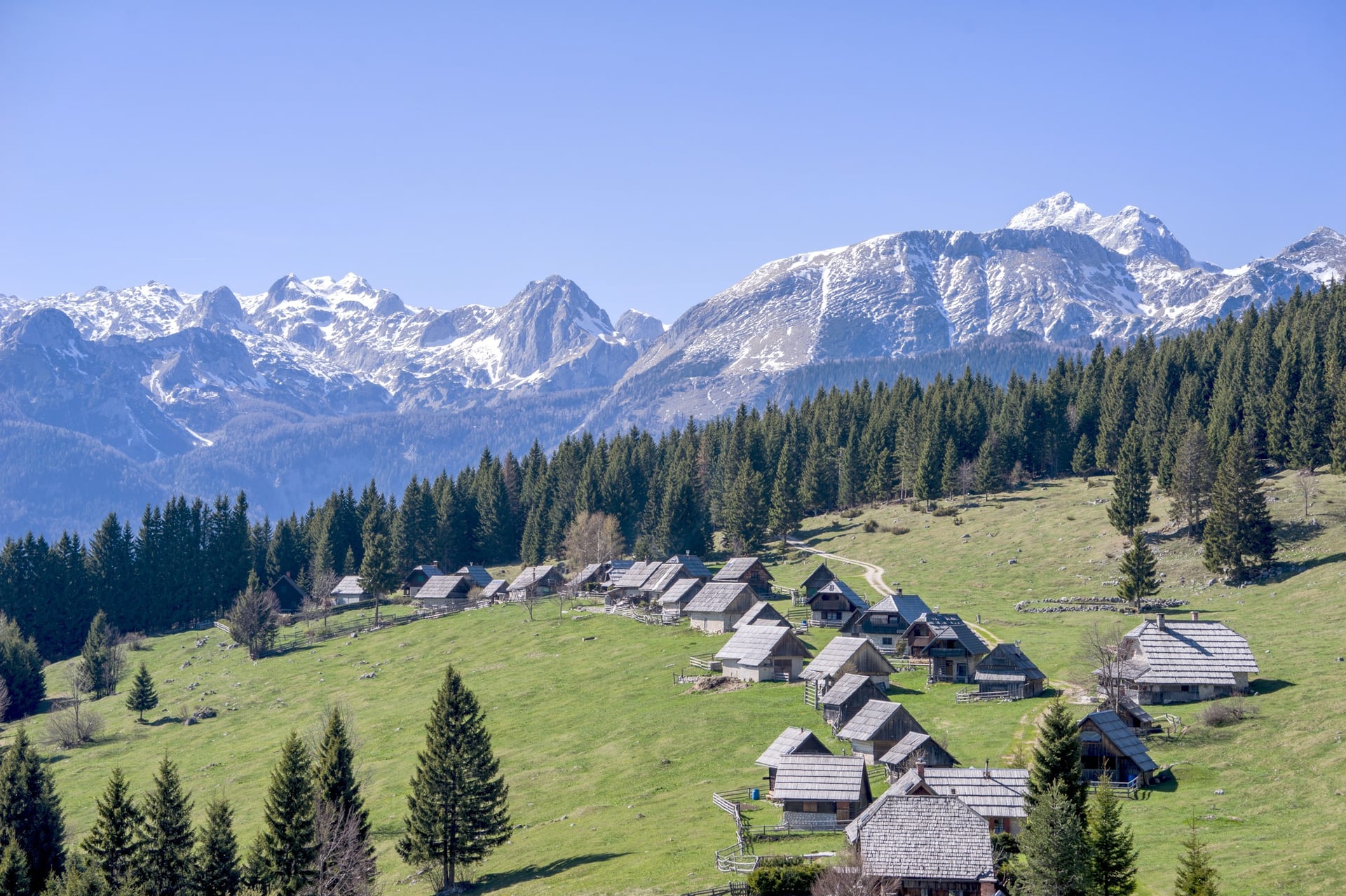
The Juliana Trail circles the Julian Alps through the valleys and foothills at their edge. You sleep in a village at the end of every stage, and no section has exposed ground or fixed cables. It opened in 2019 and links walks 1 to 6: its stages pass Bled, Pokljuka, Lake Bohinj, Mojstrana, Bovec and Kranjska Gora.
Stage 15 crosses the Predel Pass into Italy, and stage 16 returns past Rateče to Kranjska Gora, but you can start anywhere on the circle. The organisers recommend late March to late October, and the stage maps and GPX tracks are free. Collect the 24 stamps along the way and you can send them in for a diploma.
Walk 8 is in the Kamnik-Savinja Alps, north of Ljubljana.
8. Jezersko: Lake Planšar and Češka Koča
Start: Zgornje Jezersko, 881 m
Distance: 4.5 km one way
Elevation gain: 680 m
Time: 2 hours 15 up, 1 hour 45 down
Terrain: an easy mountain path with a few difficult, steeper sections
Getting there: bus from Ljubljana to Kranj, 37 minutes, then Kranj to Zgornje Jezersko, 55 minutes
Entry: free
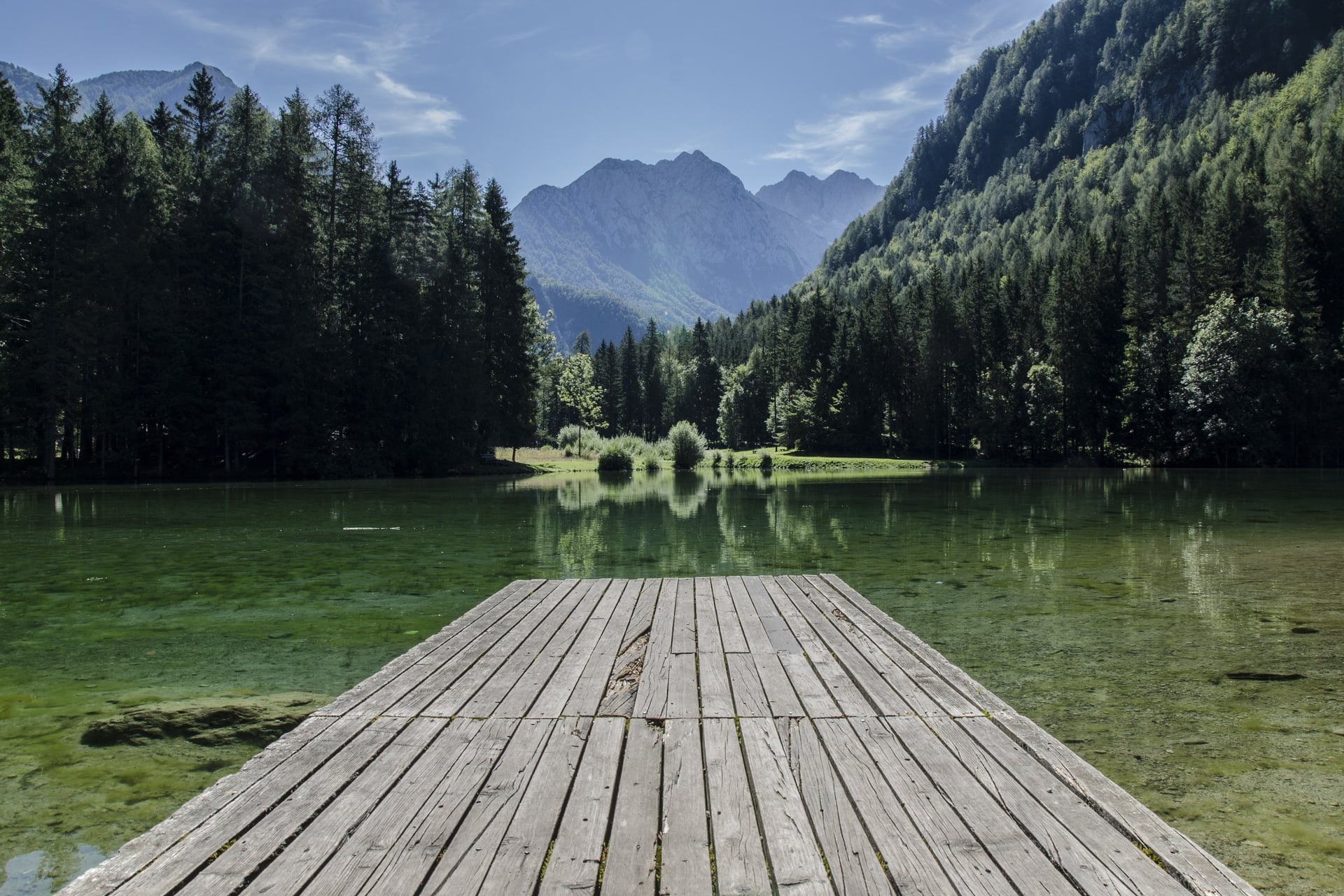
Zgornje Jezersko is a high village near the Austrian border, under the north walls of the Kamnik-Savinja Alps. The path climbs to Češka koča, a hut at 1,542 m built in 1900 by the Prague branch of the Slovene Alpine Society, and it has kept its original style through many repairs.
Lake Planšar, near the start, takes 25 minutes to walk round on a 1.5 km path. The villagers dammed it in memory of the glacial lake that gave Jezersko its name.
Walks 9 and 10 are in the south-west, between the Karst and the sea.
9. Nanos Above the Vipava Valley
Start: Razdrto, by the car park before the motorway bridge
Distance: 5.2 km one way on the gentle path
Elevation gain: 673 m
Time: 2 hours 20 up, 1 hour 50 down
Terrain: an easy mountain path through woods and pasture to the edge of the plateau
Getting there: bus from Ljubljana to Razdrto, about 1 hour
Entry: free
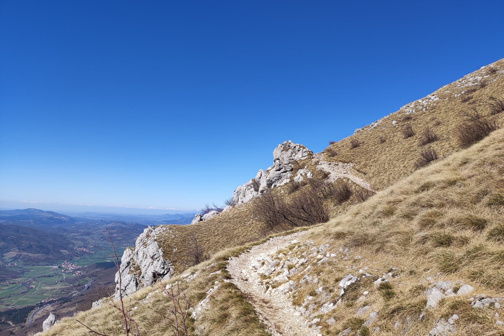
Nanos is a limestone plateau above the Vipava valley. The Alpine Association grades the gentle path from Razdrto as easy, so you never need your hands, and it reaches Vojkova koča, a hut at 1,240 m, and Pleša, 1,262 m, on the plateau edge.
Below the plateau, the Vipava valley and the Karst are walked from village to village. Vipava sits on the springs of its river, crossed by 25 bridges, and Štanjel, first recorded in 1402, has a 3 km trail named after the architect Maks Fabiani, who designed its Ferrari Garden.
10. The Parenzana Along the Slovenian Coast
Start: the east end of Izola, by the old Parenzana locomotive
Distance: about 7.7 km one way
Elevation gain: almost none, on a railway grade
Time: about 2 hours at an easy pace
Terrain: an asphalt path on the old railway bed, through two tunnels
Getting there: bus from Ljubljana to Izola, 1 hour 41; buses back from Portorož take about 20 minutes
Entry: free
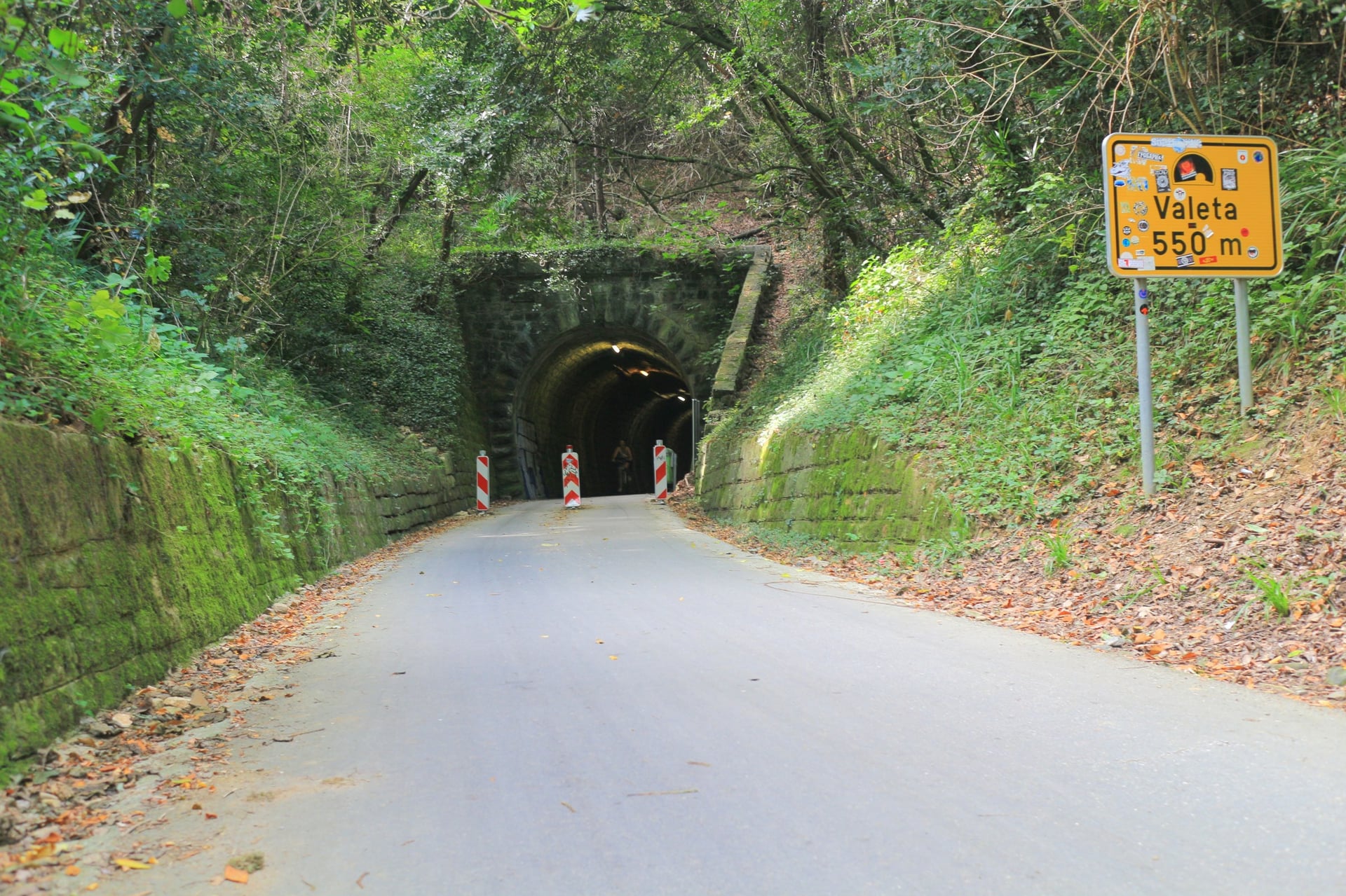
The Parenzana was a narrow-gauge railway that ran 123 km from Trieste to Poreč from 1902 to 1935. Its Slovenian section was 32 km long, and the path on its old bed is asphalted all the way, signposted as cycle route D8.
Between Izola and Portorož the path goes through the line's only two tunnels in Slovenia: Šalet, 214 m, and Valeta, 544 m, the longest on the whole railway. Valeta is lit and open all year. In between, at Strunjan, salt has been made in the traditional way for more than 700 years.
How Hard Are the Walks?
None of the ten walks needs climbing gear; the steepest are the climbs of about 700 m to Viševnik, Češka koča and Nanos.
Grades, Waymarks and Signposts
Slovenia's Alpine Association looks after about 10,100 km of marked mountain trails and grades them in three classes. On an easy trail you walk without using your hands, a difficult trail needs your hands now and then, and on a very difficult trail you use them all the time.
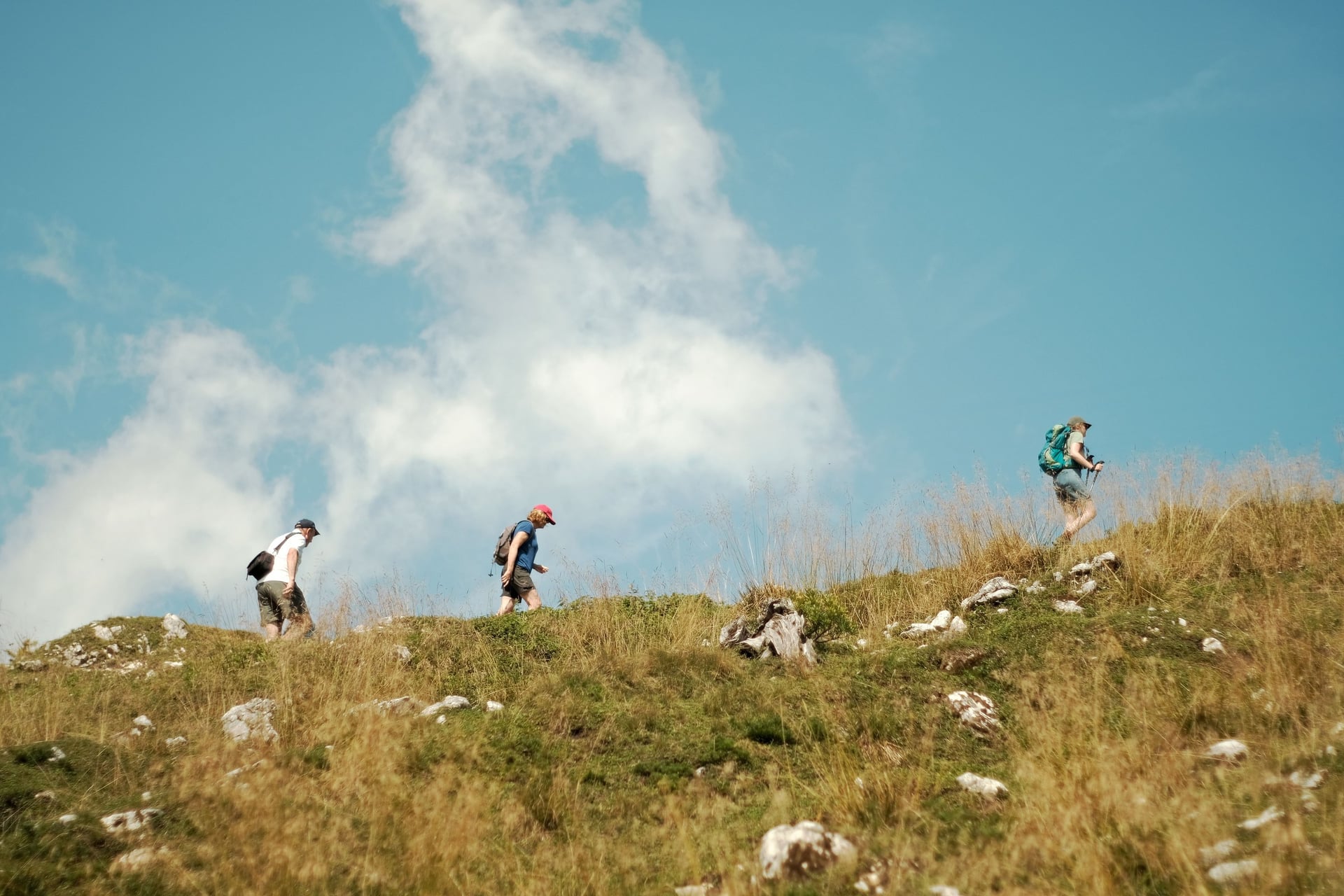
Signposts show the grade with a symbol: none for easy, a triangle for difficult and an exclamation mark in a triangle for very difficult. Each sign gives the walking time to the next hut or summit. The tourist board's rule of thumb is an hour for every 300 m of climbing or 400 m of descent.
Between the signposts, follow the Knafelc blaze, a red ring round a white dot. It has marked Slovenian paths since 1922.
Huts on the Way
Several of the walks end at a mountain hut with food and drink, and some have beds. High huts usually open only from June to September, while lower huts keep longer hours.
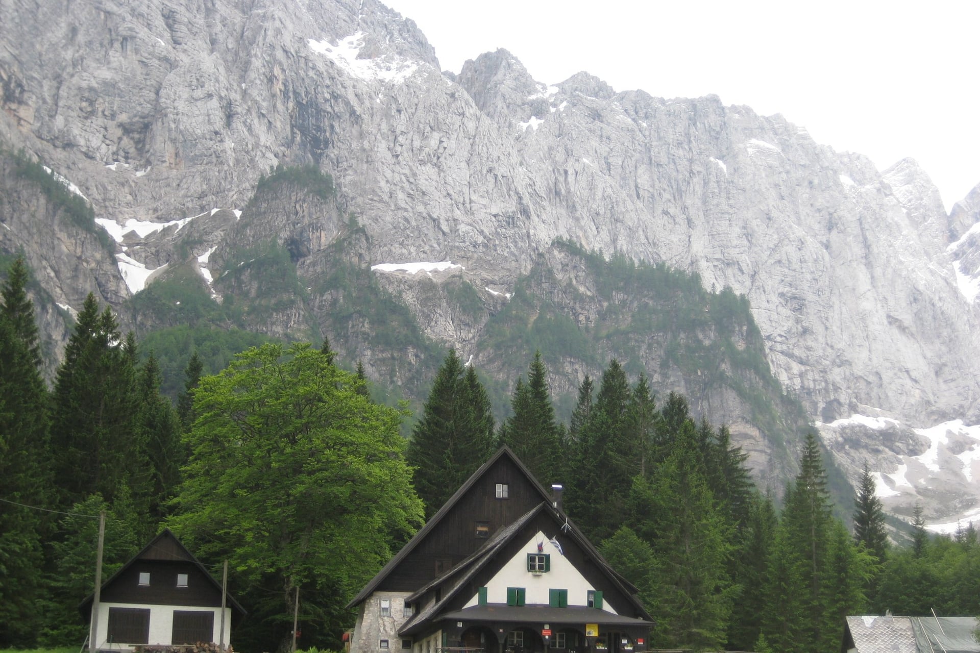
Koča v Krnici (1,113 m), walk 5: at the head of the Krnica valley; in October it opens on Fridays, weekends and holidays
Dom v Tamarju (1,108 m), near walk 5: 51 beds, open every day all year
Aljažev dom (1,015 m), walk 4: at the end of the Vrata valley below Triglav, open in the summer season
Češka koča (1,542 m), walk 8: 53 places to sleep; open at weekends in May and early June, then daily to the end of September
Vojkova koča (1,240 m), walk 9: on Nanos, open at weekends, on holidays and on three weekdays
A sleeping sheet is compulsory if you stay overnight, and high huts have very little water, so carry enough for the day.
Bears, Ticks and Storms
About 950 brown bears live in Slovenia, most of them in the forests of Kočevje and Notranjska south of Ljubljana, and their range reaches as far as Nanos. The government's advice for walkers:
Make some noise in dense forest and where you cannot see far ahead
Never approach a bear; back away slowly the way you came
Keep dogs on a lead, and never feed a bear
Slovenia also has one of the highest rates of tick-borne encephalitis in Europe, about 100 cases a year, and its public health institute recommends vaccination. In summer, start early: afternoon thunderstorms are common in the Alps. The emergency number is 112.
Triglav, 2,864 m, and the routes between the high huts need mountain experience; they are in our guide to hiking in Triglav National Park.
Best Time for Walking in Slovenia
Spring and autumn are the walking seasons: the valley paths are dry, the gorges are open and the summer crowds have gone.
The figures below are average daily highs from the Slovenian Environment Agency (ARSO), 1991 to 2020. Rateče stands for Kranjska Gora, Bovec for the Soča Valley and Portorož for the coast.
Months | Kranjska Gora | Bovec | Coast | What changes |
April | 13 °C | 16 °C | 18 °C | Vintgar, Mostnica and Kozjak open; warm enough for the coast and the Karst |
May and June | 18 to 22 °C | 21 to 25 °C | 23 to 27 °C | Snow lingers on the high paths; the free Vršič bus starts on 1 June |
July and August | 24 °C | 27 °C | 29 °C | Busiest months; storms on many afternoons |
September | 19 °C | 22 °C | 25 °C | Most Bohinj shuttles stop on 1 September; the Vršič bus runs to the 30th |
October | 14 °C | 16 °C | 20 °C | Bovec's wettest month, 346 mm; Vintgar and Kozjak close at the end |
For most walks, May, June, September and October are the best months. In July and August walk early and save the afternoons for the lakes at Bled and Bohinj.
Snow can lie on the high paths into June, though none of the ten walks goes above 2,050 m. Bring a waterproof in any month: Bovec averages 2,614 mm of rain a year, nearly twice Ljubljana's 1,368 mm.
Know Before You Arrive
A car-free walking week in Slovenia runs on regional buses, a few trains and the summer shuttles, so the timetable shapes each day.
Getting There and Around Without a Car
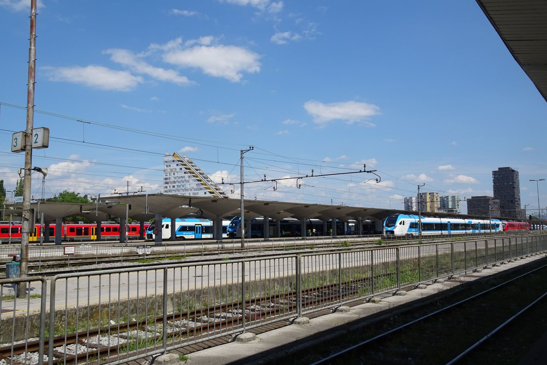
Slovenia is small: buses from Ljubljana reach Bled in about an hour and Bohinj, Kranjska Gora and Izola in under two. Ljubljana airport is the easiest way in, with buses on to Ljubljana or straight to Bled.
Buses reach most of the starts, and in summer free local buses do the climbing to Vršič and the Vrata valley. Until 12 November 2026, works around Jesenice replace some trains on the Bled and Bohinj lines with buses.
Getting to Slovenia:
From the UK: easyJet flies from London Gatwick all year, and from Manchester, Edinburgh and, from 26 October 2026, Luton; British Airways flies from Heathrow from late March to late October
From the USA: no non-stop flight in 2026; United starts flying from Newark on 12 May 2027
From the airport: buses to Ljubljana take 30 minutes and to Bled 31 minutes
Other airports: Trieste is 94 km from Ljubljana and Venice 230 km
Entry: UK and US citizens can stay 90 days in any 180 without a visa; the EU's Entry/Exit System takes fingerprints and a photo at the border
Between the walks:
Ljubljana to Bled: more than 40 buses a day, about an hour
Ljubljana to Bohinj and Kranjska Gora: hourly buses, 1 hour 45 to Bohinjska Bistrica and about 2 hours to Kranjska Gora
Kranjska Gora to Bovec: the free Vršič bus, 1 hour 48, from June to September
Bohinj to the Soča Valley: the car train from Bohinjska Bistrica to Most na Soči, 42 to 49 minutes
To the Karst and the coast: buses from Ljubljana to Razdrto, about an hour, and to Izola, 1 hour 41
Where to Base Yourself
Choose a base by the walks on its doorstep and the buses that leave from it. Bled has the most buses from Ljubljana, and Kranjska Gora is the best base for the valleys of the Julian Alps.
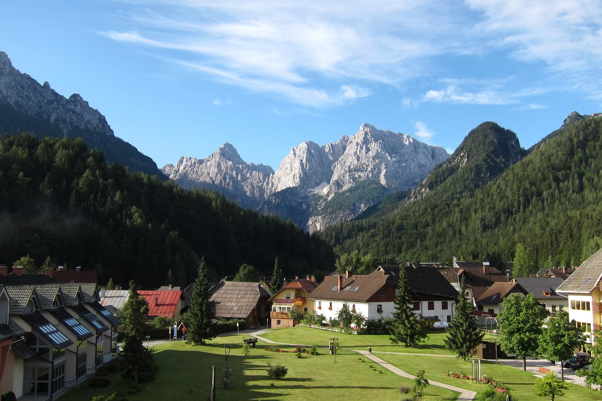
Bled (501 m): walk 1 from the door, Vintgar on foot and walk 3 by the summer Bled Bus
Bohinj, at Stara Fužina or Ribčev Laz: walk 2 from the door, and the shuttle up to Pokljuka in summer
Kranjska Gora: walks 4 and 5, the Tamar valley, and the Vršič bus over to the Soča Trail
Bovec or Kobarid: the Soča Trail ends in Bovec, and Kozjak is a walk from Kobarid
Zgornje Jezersko (881 m): walk 8 starts in the village, with three to eight buses a day from Kranj
Vipava or Izola: for Nanos and the Karst villages, or for the Parenzana and the coast
Ask your host about the Julian Alps card. In Bled it is free for guests of partner hotels and covers the Bled Bus and Mostnica Gorge; the Bohinj and Soča Valley cards are sold for a few days at a time.
How Much It Costs
Most of the walks are free; only the gorges, waterfalls and museums charge, and the summer buses in the Julian Alps are free or cheap.
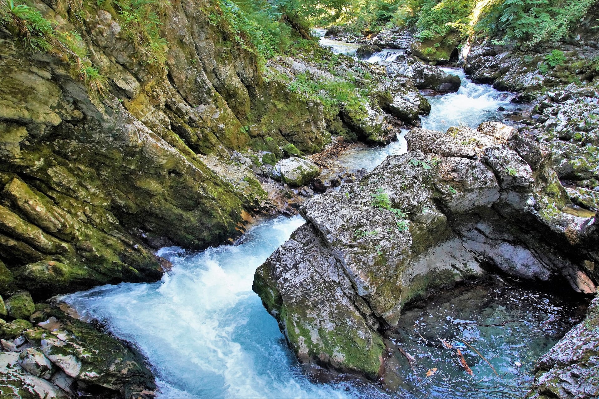
Vintgar Gorge: €15 for the All-in-One pass with the e-shuttle from Bled; €5 for children up to 15
Mostnica Gorge: €4, cash only, 1 April to 30 November
Savica waterfall, Bohinj: €4 from 1 August 2026, free under 16
Kozjak waterfall: €5, 1 April to 31 October
Slovenian Alpine Museum, Mojstrana: €10
Regional buses: Ljubljana to Bled €6.50 to €7.50, to Kranjska Gora €10 and to Izola €12.50 on weekdays, a little less at weekends
Summer buses: the Vršič, Kranjska Gora and Vrata buses are free; the Bled Bus is €5 a day and the Bohinj shuttles €2 for 24 hours
Julian Alps cards: Soča Valley €25 for 15 days; Bohinj from €21 for 3 days
Tourist tax: €3.13 per adult per night in Bled, €2.50 in Bohinj and €2 to €2.50 in Kranjska Gora
A night in a hut: a shared bed at Dom v Tamarju from €29
The Soča Valley card covers Kozjak, Tolmin Gorges and the summer shuttles in Tolmin, Kobarid and Bovec, and it includes a free return ticket on the Bohinj railway. It does not cover the regular buses.
What to Pack
Mountain weather changes fast in the Julian Alps, while the coast and the Karst can be hot by May, so pack for both.
For any walk:
Walking shoes or light boots with a good grip
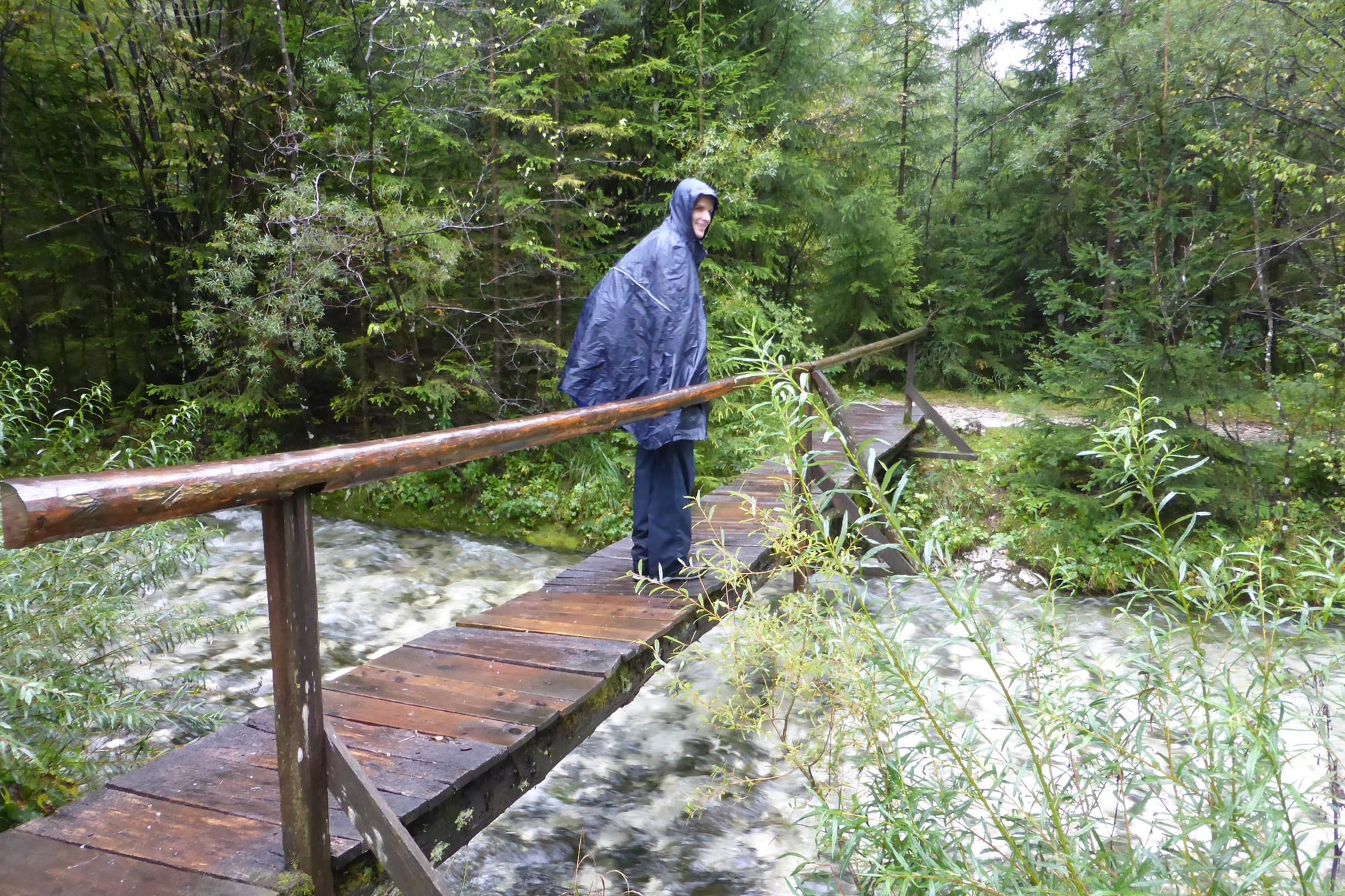
A waterproof jacket and a warm layer, even in summer
A sun hat, sunglasses and sun cream
A 20 to 25 litre day pack and a water bottle
For Slovenia:
Euros in cash for Mostnica Gorge and the mountain huts
Your Vintgar ticket for the time slot you booked
Walking poles for the descents from Viševnik, Češka koča and Nanos
Tick repellent and long trousers for grassy paths
A sleeping sheet if you plan a night in a hut
One Base or Inn to Inn?
Without a car, a walking week in Slovenia works in one of two ways: from one hotel with the walks on its doorstep, or from village to village with your luggage sent on ahead.
One base is simplest where several walks start from the village, as in Kranjska Gora or Bled. Moving on suits the Juliana Trail, whose stages end in a different village each night, but booking 16 beds and carrying your bags is the hard part.
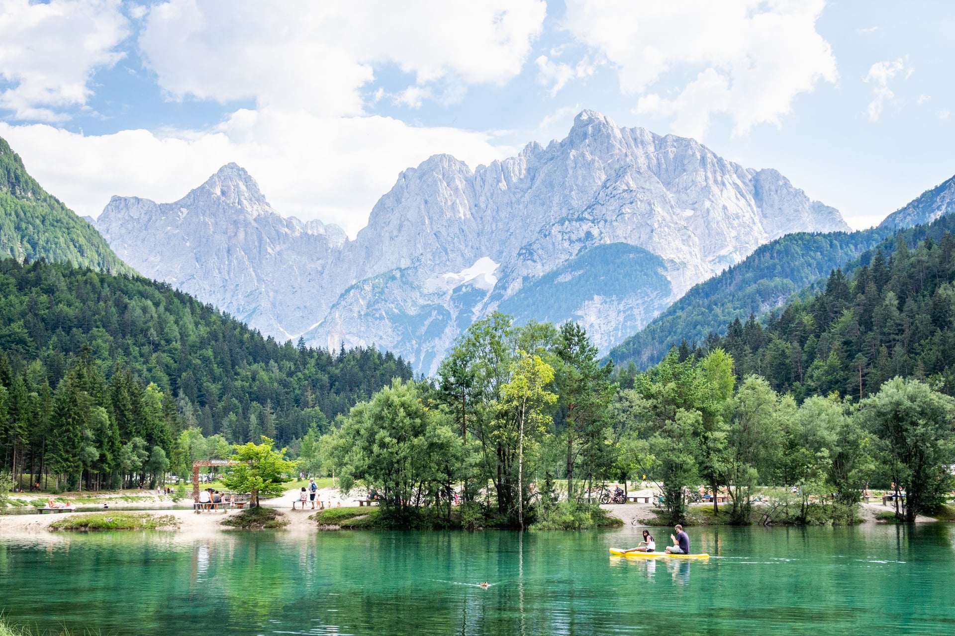
Our self-guided walking holidays take care of that. We book 3-star hotels, guesthouses or B&Bs with breakfast and give you a digital guidebook, a GPS app and support while you walk.
The best of the Juliana Trail: Juliana & Alpe Adria Trail Highlights is 9 days from Kranjska Gora to Bled, April to October, inn to inn with your luggage moved. It walks from Lake Jasna to the Vršič Pass, down the Soča Trail to Bovec, Kobarid and Tolmin, takes the train to Bohinj and crosses Pokljuka to Bled.
The whole trail: the Juliana Trail Hike is 17 days from Bled round to Bled, April to October, with 15 walking days of 8 to 25 km and luggage transfer.
One base: Kranjska Gora Walking Holidays is 6 days in one hotel, May to October, with the Krnica valley, the Martuljek falls, Tamar and Slemenova špica by local bus.
Ask us about dates, or see all our Slovenia walking holidays.
On the last walking day of that week, the path drops through the Pokljuka Gorge to the villages of Gorje, and Lake Bled comes into view below its castle.
Frequently Asked Questions



Plan with a hiking expert
Free advice from a team that knows these routes inside out - real people, not a bot

Expert Local Guides
Our professional guides know the best places, are great to be around, and will go that extra mile for you.

Tried & Tested Adventures
Only the best hiking adventures in Slovenia, cherry-picked by our local team with an in-depth knowledge of the region.

Hassle-Free
We handle route planning, accommodations, transfers, and anything else you prefer not to deal with, so you can enjoy a carefree hike.

Trusted by Many
We are a financially protected company operating since 2014, and with thousands of satisfied customers in the past, we still put you first.

Unbeatable Support
Our 24/7 customer support is where we show our passion, bringing you a better experience by making your well-being our number one priority.